Springfield sits at roughly 586 feet above sea level, atop a complex layering of glacial till, Pennsylvanian bedrock, and buried paleo-valleys that complicate any foundation design. The Sangamon River and its tributaries have carved hidden channels through the city’s subsurface over millennia, leaving soft organics and irregular bedrock surfaces that standard borings often miss. Seismic tomography bridges this gap by generating a continuous velocity cross-section of the subsurface, mapping bedrock topography and low-velocity zones without the interpolation guesswork of discrete boreholes. When a developer in the medical district needs to confirm that bedrock is uniform beneath a planned six-story structure, refraction and reflection surveys provide the lateral continuity that isolated spt-drilling logs simply cannot deliver. The data feeds directly into IBC site classification and ASCE 7 ground motion parameters, giving the structural engineer a defensible Vs profile for seismic design.
A continuous 2D velocity profile reveals hidden channels and pinnacles that discrete borings can miss entirely in Springfield's buried bedrock terrain.
Service characteristics in Springfield Illinois
Local geotechnical conditions in Springfield Illinois
Springfield’s downtown core expanded over historic coal mine workings and undocumented fills from the 19th century, and the city’s east-side commercial corridors sit atop glacial lake deposits that can amplify seismic shaking despite Illinois’ relatively moderate seismicity. Skipping a geophysical survey in these areas means accepting an unknown bedrock profile and risking differential settlement where soft sediments pinch out against rock ridges. The New Madrid Seismic Zone, though 150 miles south, still imposes long-period ground motion demands that affect taller structures; seismic tomography provides the site-specific Vs30 measurement that the IBC requires for Site Class determination. Without it, a designer defaults to conservative assumptions that inflate foundation costs by 15-25%. The tomography data also reveals solution cavities in the underlying limestone—a known problem in Sangamon County—before they become a construction surprise.
Our services
Our seismic tomography services in Springfield are designed to integrate directly with the geotechnical program, not operate as a standalone black box. We coordinate with the drilling crew so that seismic lines cross key borings, allowing the velocity model to be calibrated with actual lithology. This integrated approach reduces uncertainty and gives the project team a unified ground model.
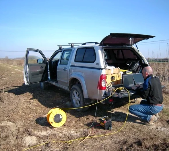
Refraction Microtremor and MASW Combination
We combine active refraction spread data with passive surface wave (MASW) processing to produce a continuous Vs profile from the surface to 100+ feet, satisfying IBC Site Class requirements without the need for a deep borehole in every building footprint.
High-Resolution Reflection for Deep Bedrock Mapping
For projects that require depth to bedrock confirmation beyond 150 feet—such as deep foundations for hospitals or parking structures—we deploy a 48-channel system with a weight-drop source and common-midpoint stacking to resolve reflectors at depths exceeding 500 feet.
Questions and answers
What does a seismic refraction or reflection survey cost for a typical commercial lot in Springfield?
For a standard commercial lot requiring one or two seismic lines with a 48-channel array and a weight-drop source, the fee typically runs between US$2.570 and US$5.340. The spread length, number of shots, permitting requirements, and whether reflection processing is needed all influence the final scope and cost.
How long does it take to get results from a seismic tomography survey?
Field acquisition for a single refraction line usually completes in one day. Data processing and interpretation require an additional three to five business days, though we can deliver a preliminary velocity profile within 48 hours when the foundation contractor is waiting on a go/no-go decision.
Can seismic tomography see through asphalt and concrete?
Yes. We mount geophones on paved surfaces using quick-set plaster or wax couplant, and the source energy from a sledgehammer or weight drop penetrates through pavement into the underlying soil and rock. Urban noise from traffic can degrade reflection data, so we often schedule urban surveys on weekends or during low-traffic windows to improve signal-to-noise ratio.
How does the IBC use seismic tomography data for site classification?
The IBC classifies a site based on the average shear wave velocity in the upper 100 feet (Vs30). Refraction tomography provides P-wave velocities, and when combined with MASW or downhole data we derive the S-wave velocity profile, calculate Vs30 directly, and assign the Site Class (C, D, or E) that governs the seismic design forces in the structural analysis.
What are the limitations of seismic refraction in Springfield’s geology?
Refraction requires that velocity increase with depth; a soft clay layer beneath stiff till creates a velocity inversion that refraction alone cannot resolve. In those cases we add reflection processing or incorporate MASW data to correctly identify the low-velocity zone. Urban utilities, buried concrete, and high background noise near active construction sites also require careful survey design to avoid data artifacts.